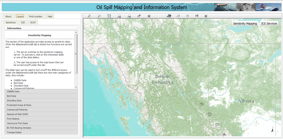
Oil Spill Mapping and Information System (version 1.0) is an Internet based GIS application using map server technology that provides access to sensitivity data along the coast of British Columbia. This application can be used before, during and after an oil spill for viewing sensitivity data. It brings together spatial data in relationship to oil spills. These data sets include physical, biological and human sensitivity.
I programmed this internet based geographic information system application with map server technology for the Faculty of Environment at the University of Waterloo. It is making use of ArcGIS API for JavaScript (jQuery). The map data is being pulled from the University of Waterloo servers.